
Geospatial baselines & change analysis
Satellite and field data turned into baselines, land-cover change and environmental condition maps.
GIS & Spatial Analysis Consultants
Insight into trends, interactions and patterns of geographic data.
Satellite image: Niger–Benue floods, October 2012. NASA Earth Observatory (opens in a new tab)
On the agenda
Updated
COP31 is under way in Antalya (9–20 November 2026), and negotiations on a global plastics treaty continue towards INC-5.4. Each of these discussions depends on evidence about specific places. These are geospatial projects we are ready to take on in the Niger Delta.
COP31
COP30 adopted voluntary indicators for the Global Goal on Adaptation. COP31 is discussing how to put them to use.
What we could mapCommunity-level baselines for flood exposure, coastal erosion and access to water, ready to report against the indicators.
Source: IISD (opens in a new tab)
COP31
Cutting methane is a near-term priority, with a Global Methane Pledge ministerial meeting at COP31.
What we could mapSatellite mapping of gas flaring and methane hotspots across the Niger Delta, tracked over time.
COP31
Parties are pushing to make nature-based solutions, such as intact mangroves, central to adaptation.
What we could mapMangrove extent, loss and restoration monitoring, combined with participatory mapping alongside coastal communities.
View CAPws proposalCOP31
The Fund for Responding to Loss and Damage is now operational and receiving funding requests.
What we could mapExposure and impact mapping for flood- and spill-affected communities, to support evidence-based funding requests.
Source: WRI (opens in a new tab)
INC · UNEP
Negotiations on a legally binding instrument on plastic pollution, including in the marine environment, continue towards INC-5.4.
What we could mapMapping plastic leakage hotspots along creeks and waterfronts, and the waste infrastructure that serves them.
Source: UNEP (opens in a new tab)
Project ideas, not completed work.
Talk to us about one of theseVertical Aspects is a Geographic Information Systems and remote sensing consultancy. We collect, analyse and present geospatial data, from interactive maps and dashboards to geodatabases and reports, for government agencies, non-profits and private companies.
Satellite and field data turned into baselines, land-cover change and environmental condition maps.
Spatial evidence for impact assessments, spill response and community-level risk.
Ground-truthing, mobile data collection and community mapping, done with the people who live there.
ArcGIS-based databases, interactive maps and dashboards that fit how your team already works.
Selected work across the Niger Delta.
Mapping informal waterfront communities in the Niger Delta facing the threat of demolition.
 Social impact
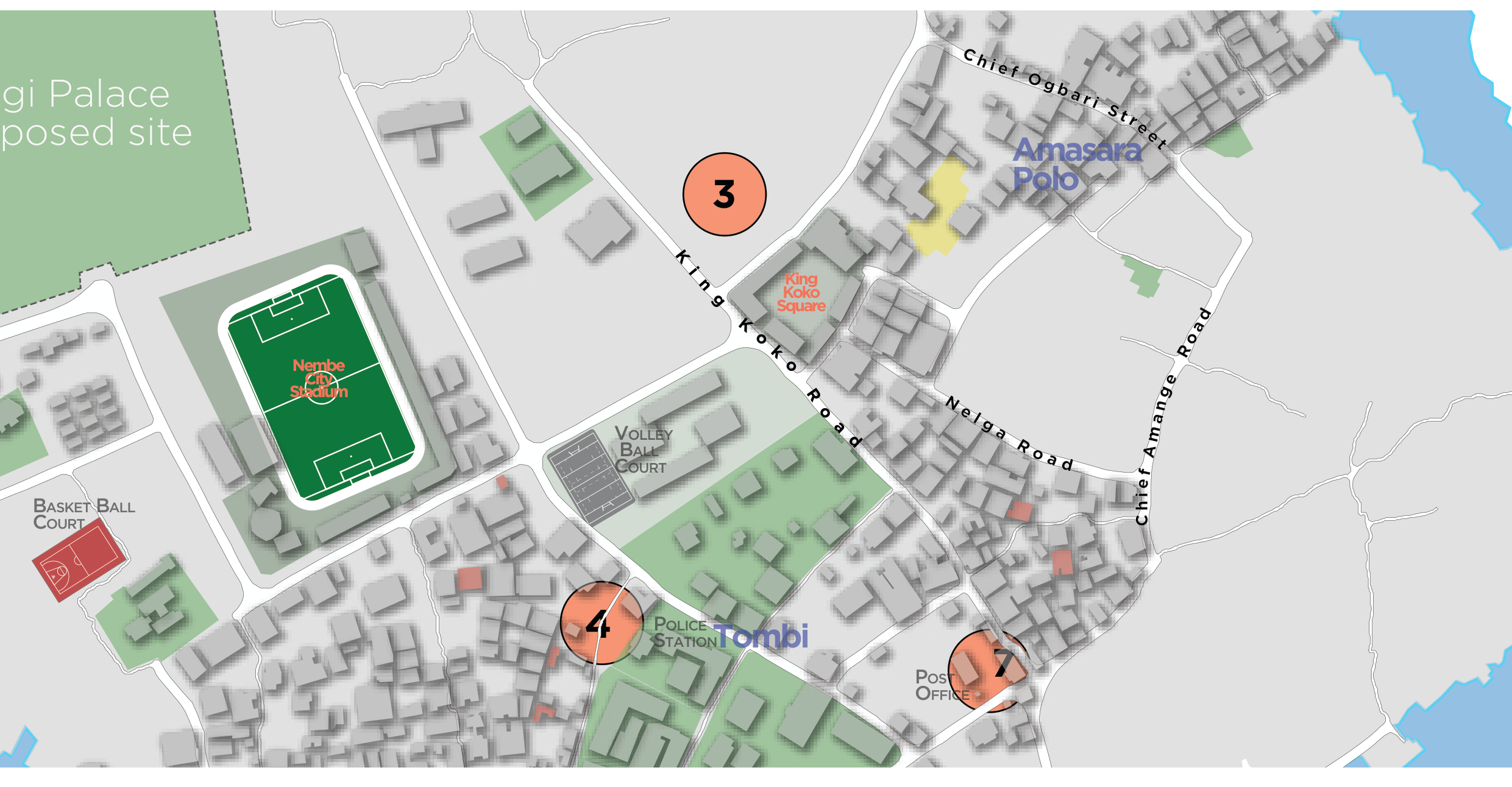
Pro-bono community mapping of landmarks, public facilities and points of interest on Nembe Island.
Geospatial support to environmental impact management following the KS Endeavor incident at Koloama.
 Bayelsa State Ministry of EnvironmentNembe Local Government Area
 Rivers State Ministry of Environment
Technology partner

Founded in 2018 and headquartered in Port Harcourt, Vertical Aspects works with government agencies, non-profits and private companies.